By Michael Scott Hill
A changing climate
The Australian island state of Tasmania is located between 40 and 43.3 degrees south, surrounded by the Southern Ocean (to the south and west), the Tasman Sea (to the east) and Bass Strait (to the north). Tasmania is one of the world’s last accessible wilderness frontiers, with no landmass west until South America, nothing south until Antarctica, and nothing to the east until New Zealand. The island became separated from the Australian mainland approximately 12,000 to 15,000 years ago when the ice caps melted and sea levels rose to flood a land bridge that once connected the island to the mainland, after the breakup of the super continent, Gondwanaland.
Tasmania is essentially a mountainous island with a generally moist climate, except in the south-west and south-east, which can suffer from drought. It has maritime and mountain climates with rainforest thrown into the mix. Rainfall varies dramatically across the island. Hobart, the capital has an average of 626 millimeters making it Australia’s second-driest capital city (after Adelaide), while on the west coast, an annual average of 2,400 mm ensures the rainforest thrives.
The recent big fire seasons experienced, such as in 2016 and 2019, will become more common — as found by climate scientists at the University of Tasmania’s Antarctic Climate and Ecosystems Cooperative Research Centre working on its Climate Futures for Tasmania project. They discovered a relatively uniform rise in the mean temperature has been occurring across Tasmania, and with this rise has come an annual downward trend in rainfall. They also found the surface water temperatures off the east coast have warmed approximately 2°C over the past 60 years, and project this to increase, as the warm East Australian Current to the north is expected to extend southward along the Tasmanian coast. The changing temperatures are believed to be creating a destabilization in the historic weather patterns of Tasmania and are predicted to bring into play an increase in the frequency and severity of extreme weather events for Tasmania’s future. Across the state rainfall intensity and associated flooding have been recorded to be increasing and between these heavy downpours are coming more and longer heat waves and summer dry periods.
An extreme fire season
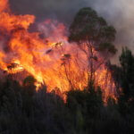
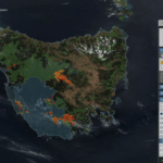
This season Tasmania’s fire experience began with the Gell River blaze started in late December 2018 by a dry lightning storm in the state’s south-west. In Tasmania’s dry conditions fires are known to make large spectacular wind-driven runs then to lie down deceptively quiet until they start off again intensively. The Gell River Fire burning just north of Gordon Lake followed the pattern in early January 2019, growing rapidly in size in remote backcountry. During a period of its fire growth, the dilapidated structure of Churchill’s Hut was consumed by its flames. This hut was famous as the historic trapper’s shed of Elias Churchill, who captured the last Tasmanian tiger. Tasmanian fire managers took this loss as signal to begin wrapping other important structures lying in the Gell River Fire’s path.
January proved to be the driest month on record in Tasmania, as the Gell River’s flames continued to spread outwardly moving up into rugged inaccessible terrain. In the middle of the month another series of lightning storms ignited new fire starts around the state, several of which also made spectacular runs across Tasmania’s vegetation. Professor David Bowman of Pyrogeography and Fire Service at the University of Tasmania, as reported in ABC News at the time, described what was taking place by saying, “Usually dry lightning isn’t a significant factor in starting bushfires because the vegetation was traditionally too moist.” And adding, “But certainly the coupling of dry lightning with dry vegetation has created an increase in both the number and the area burned.”
New fires from the dry vegetation being lit by more dry lightning bolts, added to complexity of dealing with the large Gell River Fire burning on Tasmania’s remote forested Central Plateau region to the south-west of Hobart, the state’s Capital City. Here during an annual summer season fire managers typically face only one large bushfire at time, yet now they had a number spreading out independently. The multiplying fire spreads and starts, impacted fire managers who were overseeing so many fires in January, as their resources were being divided. An Interstate relief effort was put in place to provide more fire fighters and specialists, but due to multiple fire-staffing requirements these resources were spread out across the island and it became difficult for fire managers to be able to prioritize their focus.
On January 22 the Skittle Ball Plains Homestead, a fishing retreat was burned by the Central Plateau fire out near the Great Lake, and in the days after, by January 30, the Tahune fire, near the Tahune forest, had grown to 56,000 hectares. It threatened a large urban interface area to the south of Hobart known as the Huon Valley. At its peak the fire displaced hundreds of residents and its flames badly twisted one of Tasmania’s most popular tourist attractions, the Tahune Airwalk, a steel canopy walkway which gets about 80,00 visitors a year.
Into February, with fire in thousand-year-old pines

By early February 187,00 hectares of Tasmania had been exposed to fire, and the Wilderness Society — fearing for the protection of the world’s largest remaining forest of irreplaceable thousand year-old King Billy pines made famous by a photographer in the 1980s and 90s — made the following statement as they began lobbying Australia’s top politicians to request international fire assistance: “The scale of the fires, with over 2.5 per cent of Tasmania burnt or burning, has overwhelmed firefighting capacity to the extent that little is available to combat remote fires in the Tasmania Wilderness World Heritage Area.” Tasmania Parks and Wildlife Service are also concerned for the survival of the King Billy and the equally endangered Pencil pines as well as other relic Antarctic species, and they have been refining and drilling on their tactics using mobile sprinkler kits, to protect these very sensitive rare plant communities from wildfire since the tragedies of the 2016 fire season.
And then the rains came
The 2019 peak fire season roughly came to an end in mid-February when rain and a small amount of snow finally pushed in by a couple of cold fronts reducing the severe threats. Only three summers before, the 2016 Tasmania fire season had been considered unprecedented. When that fire season of 2016 wrapped up in February of that year, an official Tasmania Government press release declared, “Not a single life or properly was lost, and only about 1.3 per cent of our Wilderness World Heritage Area was affected. This is despite more than 300 fires, more than 120,000 hectares burned and a record 15 total fire ban days, five more than any previous year.”
What we learn — as firefighters and climate change managers
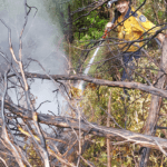
I joined the Tasmania fire-fighting effort in 2019, like I had in 2016, this time operating with a team of remote area firefighters in the island’s rugged west coastal region as part of two important efforts. One was a large burn out along a road system to protect a powerline that carried one half of Tasmania’s electricity, carried cross the rough Bass Straits in an undersea cable from the Australian mainland. I spent much of this deployment, however, as part of another effort, being carried into remote river systems by boat or chopper. We used water here to mop up smoky pockets of organic soil deposits smoldering in deep gullies of dried out rainforest where earlier fire runs had been slowed when encountering its thick vegetation in prevention of future large fire runs occurring from that fire perimeter.

As one of the world’s frontiers of climate change with its unique fire environment, Tasmania is a remarkable and diverse place to be able to fight fires in — from its western rolling-hill-covered button grass moorlands, onto its rainforest, and high country groves of massive gum and fern trees, even further to its even higher, scrubby alpine plant communities and timber plantations.
With temperatures rising and rainfall decreasing, the story of fire is one that will continue to be transforming as climatic change takes place across the world. In Australia, its landscape in many places was historically managed using the fire of thousands of generations, under the guardianship of Indigenous Australians elders who understood the various sensitivities of plant and animal communities, and their fire and land management regimes ensured abundant wildlife, plants, and foods were available while they also decreased fuel loads.
Aboriginals were very skilled fire managers as custodians of the land. They shaped much of the fire dependant ecosystems of Tasmania, just like in the mainland of Australia using seasonal knowledge, and the knowledge of animals and vegetation types passed down by the generations. Now, here in Tasmania, we are looking at a situation where a change of the climate is taking place alongside a long period of growth and corresponding fuel build ups that have developed since that pattern of burning ceased.
Tasmania’s wildfires, due to the influences of future predicted extreme weather patterns are only set to become more and more frequent. And this pattern in itself is not very far out of step with the past, from that distant time, when Aboriginals historically over tens of thousands of generations shaped much of Tasmania’s historic vegetation mosaic with skillful applications and withholdings of fire.
Today, however, the selective and careful fires that they once carefully managed are gone from this island ecosystem — replaced by fire protection efforts and a few small scale burn programs. The unique landscape of plant and animal communities the Aboriginals nurtured still largely exist here, some which are fire dependent and others unable to tolerate fire. Fortunately, Tasmania’s annual wet climate has been assisting in fire protection, but in some areas this vegetation has been allowed to build up into unprecedented levels.
Change is here for Tasmania with these more extreme weather patterns becoming normalized, and for fire, as in much of Australia, it is once again coming home as an ecological regulating force, and we as humans, must once more adapt and use fire as a tool.
+
Michael Scott Hill manages fire and aviation with a global perspective from a home base in Virginia in the United States. He is a contributing editor of Wildfire Magazine and wrote about the 2016 fires in Tasmania — see https://www.iawfonline.org/article/the-tasmanian-fires-of-2016/ for his report.
