by Robert “Zeke” Ziel
Alaska is nearly 18% of USA landmass. Its size is often unappreciated, as it’s frequently shown in whole without other states as reference. It stores about 1/3 of US carbon, and is the only place in the United States where permafrost exists, as both a value and a hazard. Upon first inspection, fire behavior manifest on this landscape may seem typical. I hope to persuade you that the range of variability from year to year leaves “typical” wanting as a descriptor.
Like much of the boreal forest, fire in Alaska follows an understandable pattern – large stand replacement fires that are difficult to suppress on remote ground. Average depictions of Alaska fire seasons don’t represent fire’s impact very well, and there are few examples where the average tells our story.
In the last 25 years, over half of Alaska’s fire disturbance came in the three much above average seasons of 2004, 2005, and 2015. In these exceptional years, hot and dry weather on a sufficient number of days encouraged fires to burn freely, producing the impressive acreage impact that history has shown to be possible. In each of those exceptional seasons, Alaska contributed more than half the area burned to United States totals.
While this possibility is understood, Alaska fire managers anticipate each fire season with tremendous uncertainty. They prepare to protect dispersed values from unknown threats coming at a pace that cannot be planned for, compounded by a sense of impotence when these exceptional, extreme seasons come.
Add to this the reality that few of the assessment tools that are commonplace in the western continental United States are available or effective in Alaska. Fire managers, regardless of role, have called on innovation and self-reliance to try to fill that gap. We’ve been mostly successful with this approach. But as the climate changes, these challenges test our resilience, call into question the choices that have served us in the past, and force us to consider completely new levels of fire disturbance and impact.
Human Footprint
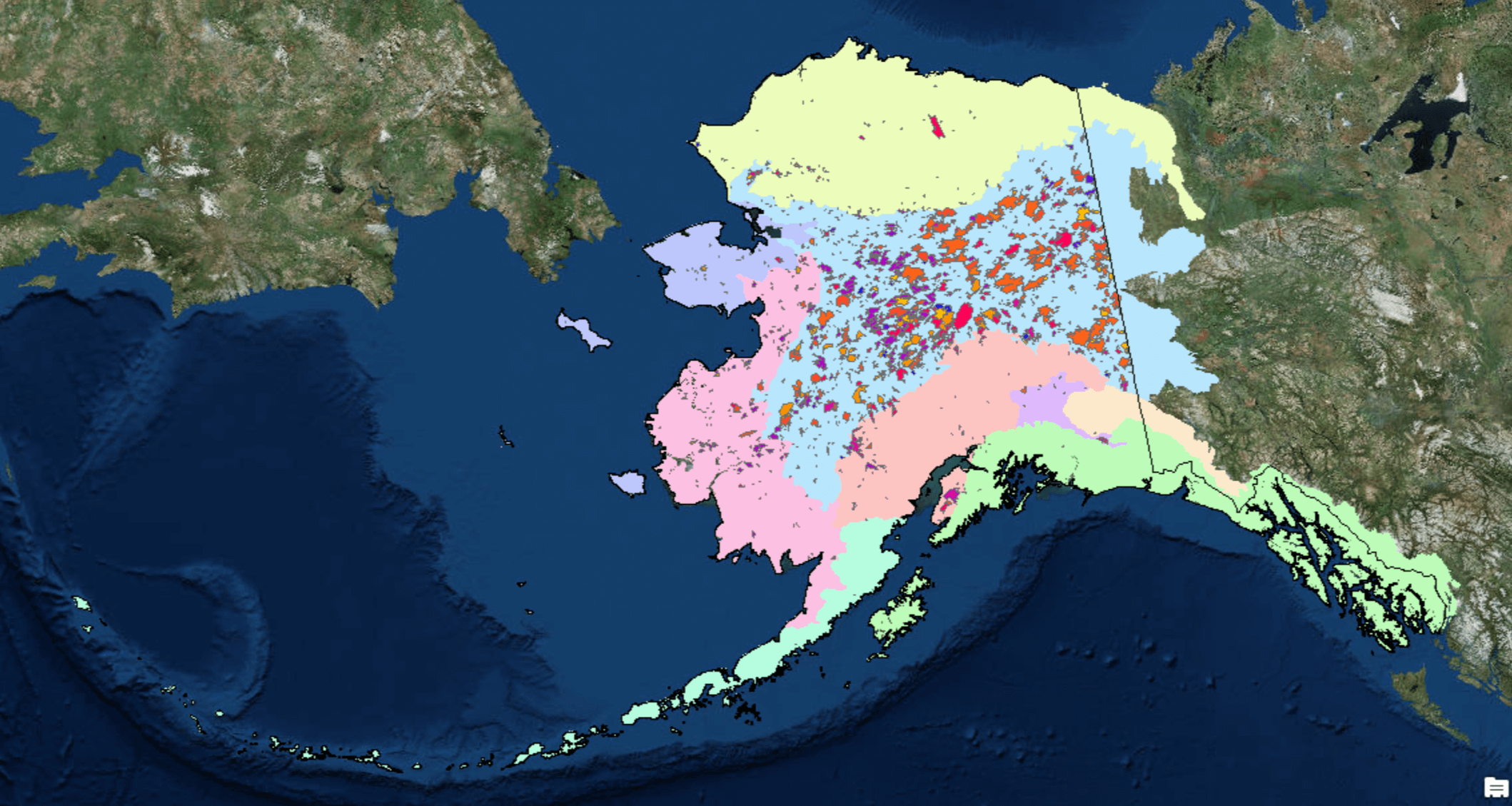
Despite having 18% of US land area, Alaska is home to less than a quarter of 1% of the US population. However, the human imprint is much bigger than the numbers suggest.
Wildfire management is strongly influenced by land ownership and land management. Though most of our fires impact land well away from established communities and out of view, the demands of human values at risk drive many decisions even for remote fires.
Between 1971 and 1980, federal legislation asserted that over 14 thousand very remote native allotments would receive fire protection regardless of their size and level of development. Point protection of these allotments from oncoming wildfires is an increasing challenge with each fire season.
The Far North Landscape
Boreal Spruce: Alaska’s Fuel of Choice
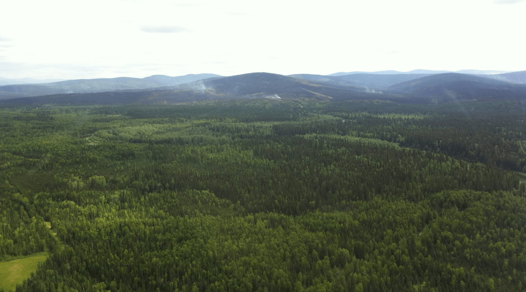
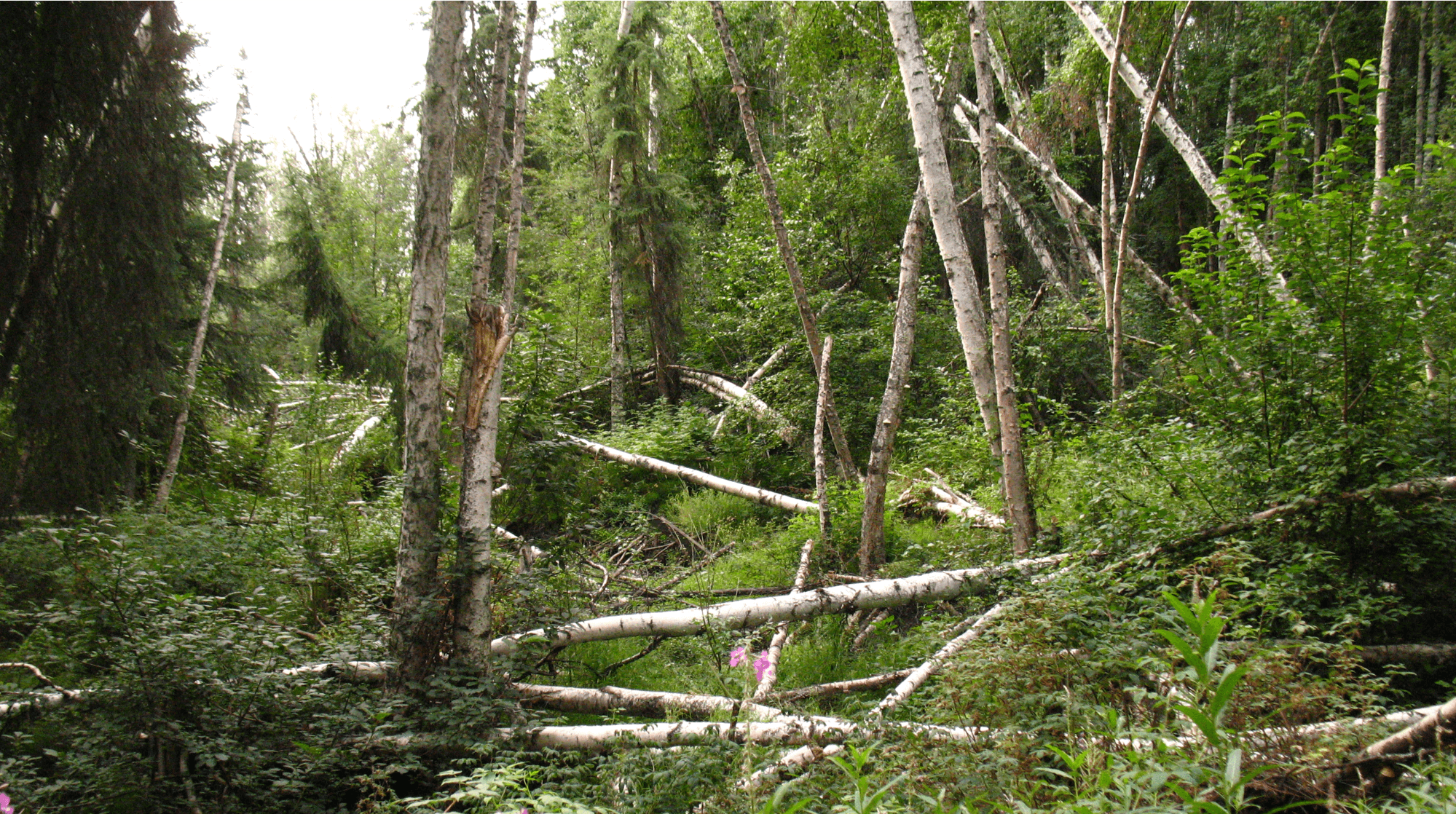
Among fire managers, there is both reverence and hatred for the black spruce forest that makes up much of the boreal biome. It’s the key element in some of the most spectacular fire events on the planet and a prolific spotter, allowing it to seek nearby patches for consumption so it can continue on its way. It grows in expanses of short straggly trees, in dense, continuous thickets, interspersed with shrub and grass tundra or deciduous stands of trembling aspen and paper birch.
It’s very hard to trust that only the more flammable black spruce will carry fire aggressively on hot, dry days during peak fire season around the June solstice. Other fuelbeds will burn, but they’re usually calmed by declining solar radiation and rising humidity on most evenings and late summer days.
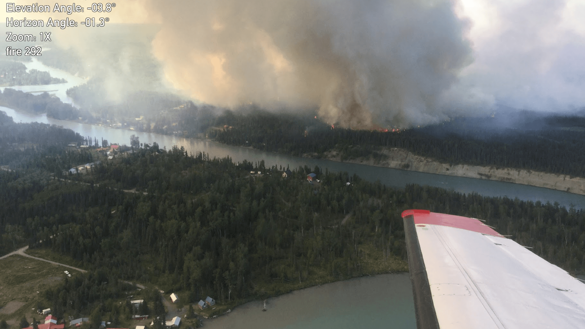
For the uninitiated, it’s a challenge to expect a fire like the one in the photo above to stop abruptly. On many fires, patches of black spruce are burned completely while adjacent stands of hardwoods appear untouched.
The boundaries are not always distinct. Mixed stands of spruce and hardwoods can be hard to detect, appearing as deciduous. But they can burn intensely, spread rapidly, and send embers spotting ahead, defying assessments from confused landscape depictions.
When weather factors moderate even a little due to clouds or smoke, the lush, green heat sink of hardwoods and tundra intermixed with black spruce can stifle active fire growth, producing an eerie, uncertain calm along the perimeter.
This green condition shows why the standard US methods for assessing the fuel curing and scaling fire potential can be lacking for Alaska.
Burn scars are the most prominent fuel treatments of the interior, leaving behind charred tree boles, hardwood sprouts and seedlings, grasses, and shrubs. Historically, it’s been assumed that these areas remain resistant to fire spread for many years, supporting only slow to moderate growth under most flammable conditions. Increasingly, we’re seeing them support fire in spring before greenup and become flammable again when drought and late-season curing permit fire to spread across their expanse.
Tundra Joining the Firescape
Though the arctic tundra ecoregion exhibits the longest fire return intervals, it appears particularly vulnerable to significant atmospheric warming.
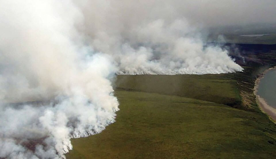
Snow can come in any month, yet arctic tundra can be subject to warm sunny days with convective storms and lightning, like the lands to the south. Long days around the solstice can dry the surface layer well enough to carry wind-driven fires many miles. There is a deceiving, hidden load of dead fuels across much of the tundra landscape, even during the peak of the short growing season. Fires in sedge and grass tundra can produce exceptional spread rates and an impressive ability to find a way through mazes of pothole ponds.
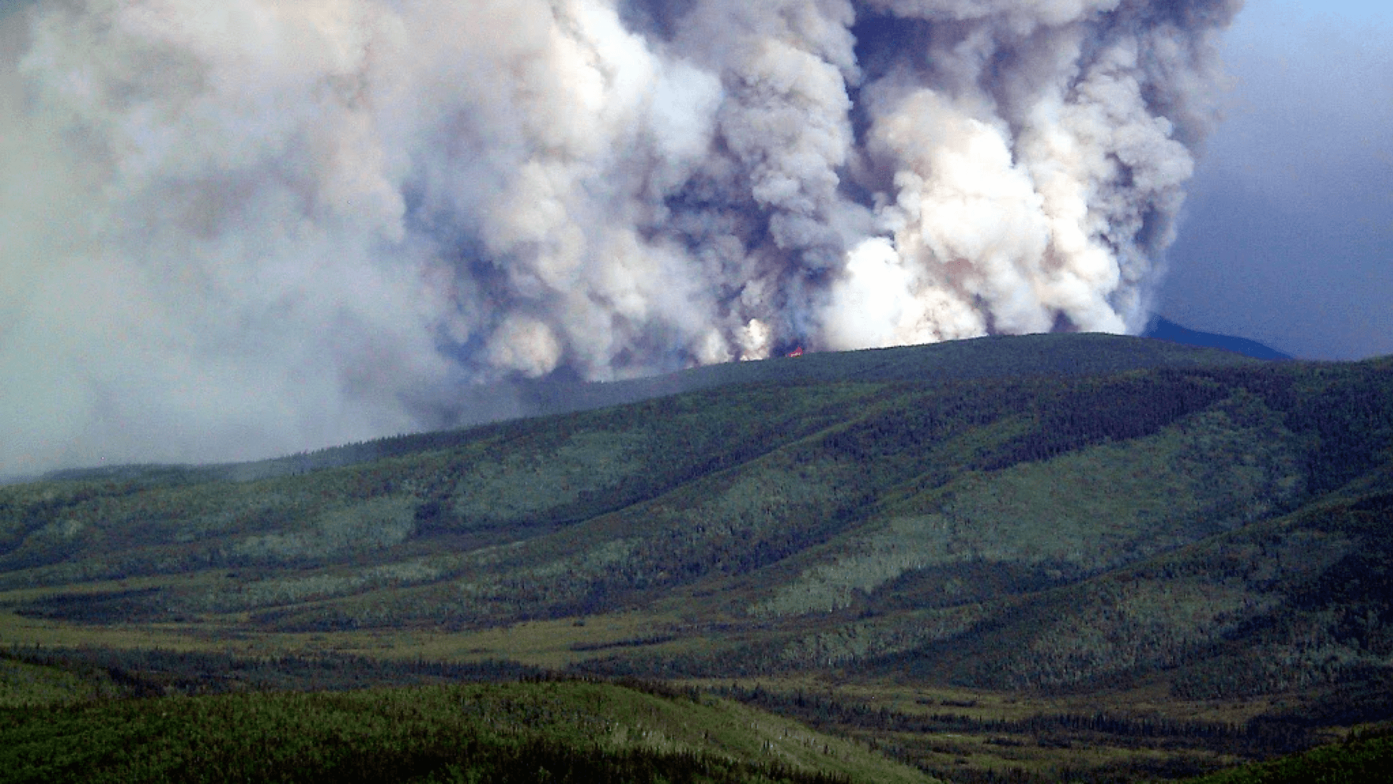
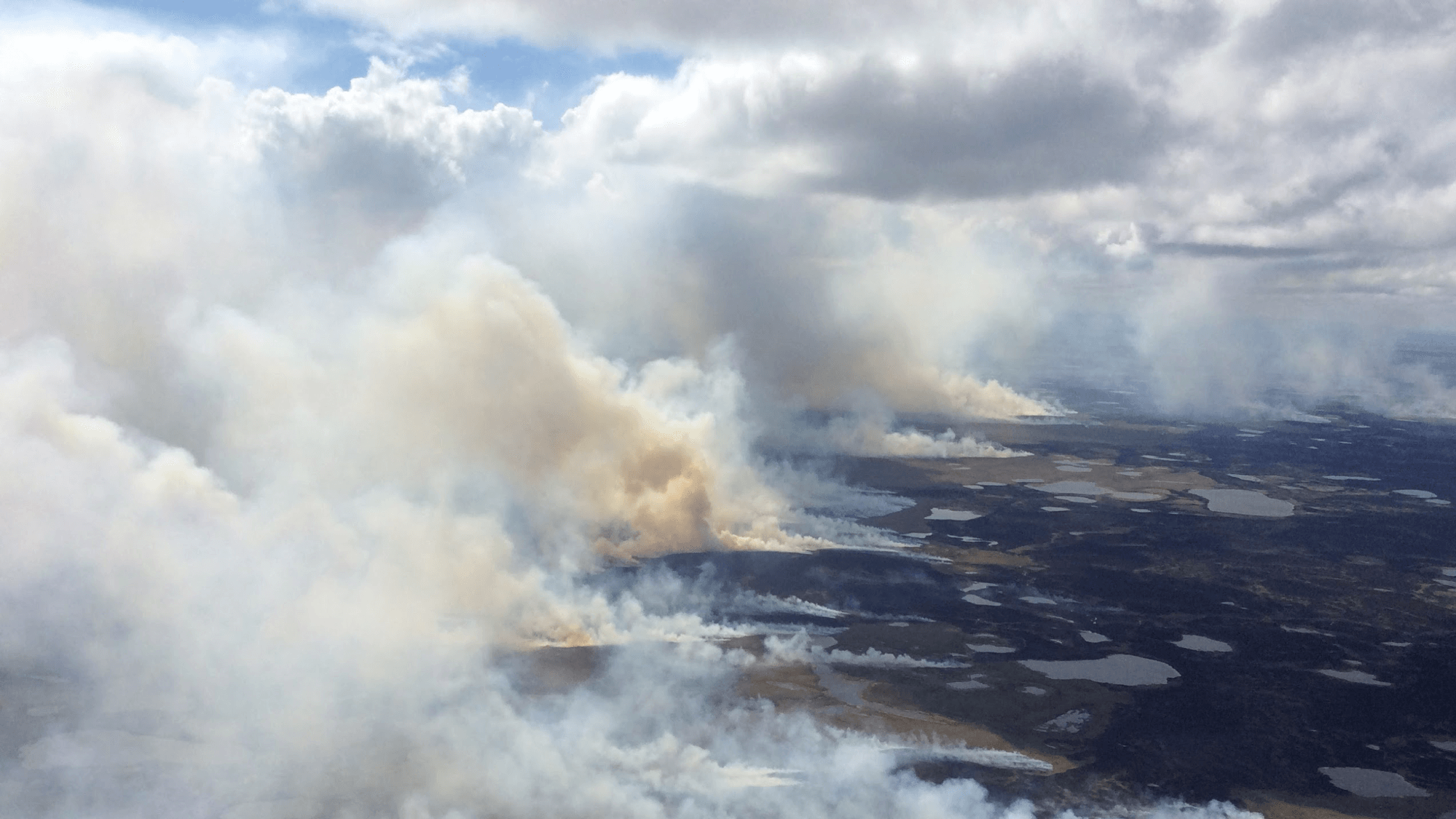
As the climate changes we see a quickening pace of fire return in the tundra; concerning us about carbon release and ecosystem resilience. The challenges associated with even trying to suppress these fires are significant. Most of the monitored fires in Alaska are on remote ground that makes it almost logistically impossible to staff and support the required resources. Consider as well, how difficult it is to ensure the safety of fireline personnel under conditions that can produce fire behavior shown below, with no escape routes and no safety zones.
Ignitions – Lightning’s Hand Expands
Ignition source often determines the management response. Ignition frequency normally determines management imperative.
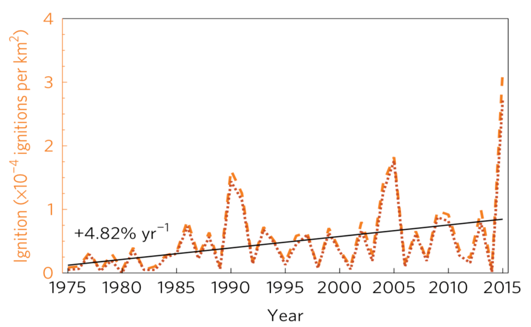
In Alaska, lightning ignitions result in the vast majority of area burned. They appear random and widely distributed across a largely unoccupied landscape. The graph below from a 2017 study shows a nearly 5% per year increase in lightning ignitions since 1975.
Precipitation on the Rise – Except Sometimes
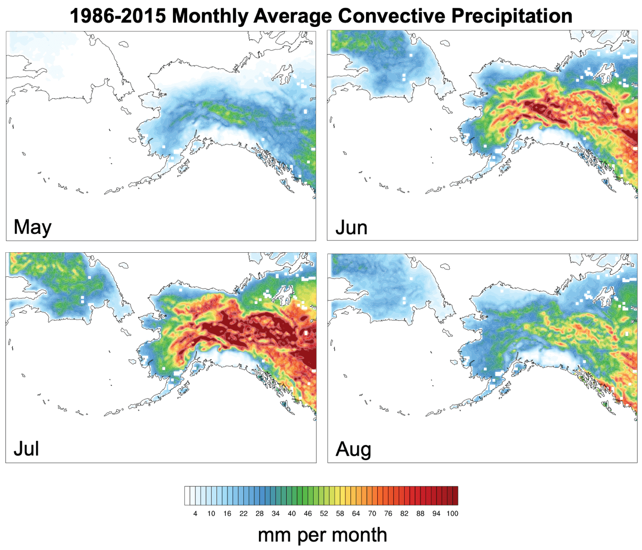
Precipitation is increasing as well. Though patterns are irregular and difficult to forecast, this trend for interior Alaska suggests that summer rainfall has been rising since the extreme season of 2004.
But the Alaska paradox continues. Extreme annual rainfall deficits occur with some regularity, with four of them in the last 15 years.
Impacts of Fire
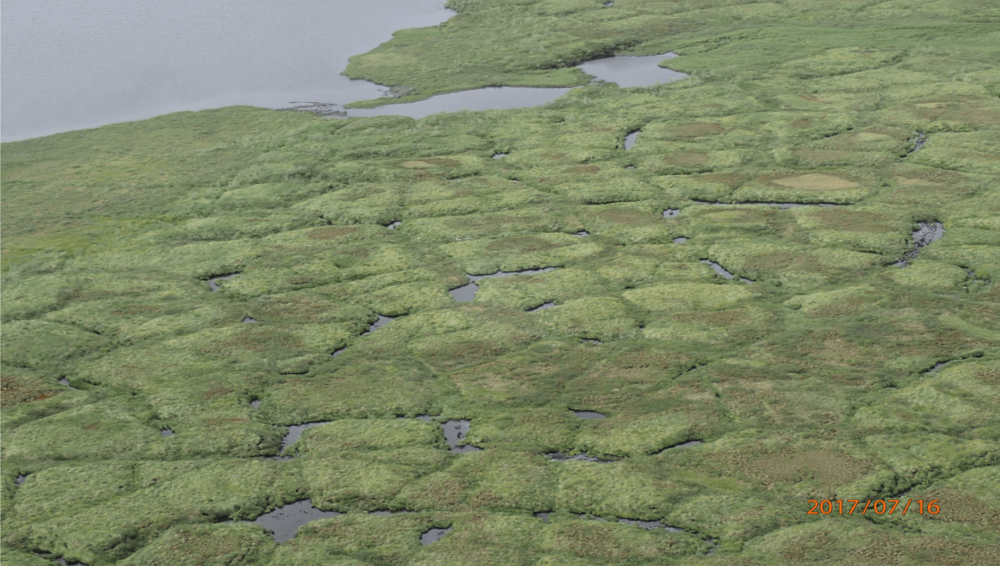
The Departure of Permafrost
Permafrost formed during the ice age over ten thousand years ago. In the far north of Alaska, arctic tundra has always insulated this underground ice from seasonal warmth. In the interior, discontinuous lobes and lenses of permafrost underlay both black spruce and tundra on north slopes and bottomlands. Alarmingly, permafrost is now thawing all across the state. Fires amplify that thawing and destabilize the ground in dramatic fashion.
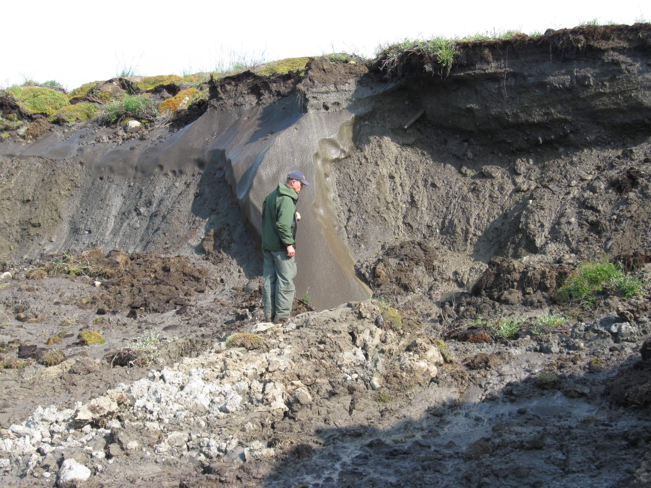
Collapsed, subsurface hollows that form when permafrost thaws are known as thermokarst. The tundra landscape in the image below was charred by a single fire in 2007. Little thermokarsting was evident two years post-fire, but by 2014 significant collapse was evident. Examination of similar karsting in older fire areas shows that permafrost loss continues for decades. Often the surface water drains away leaving much drier tundra that’s more susceptible to fire.
Smoke
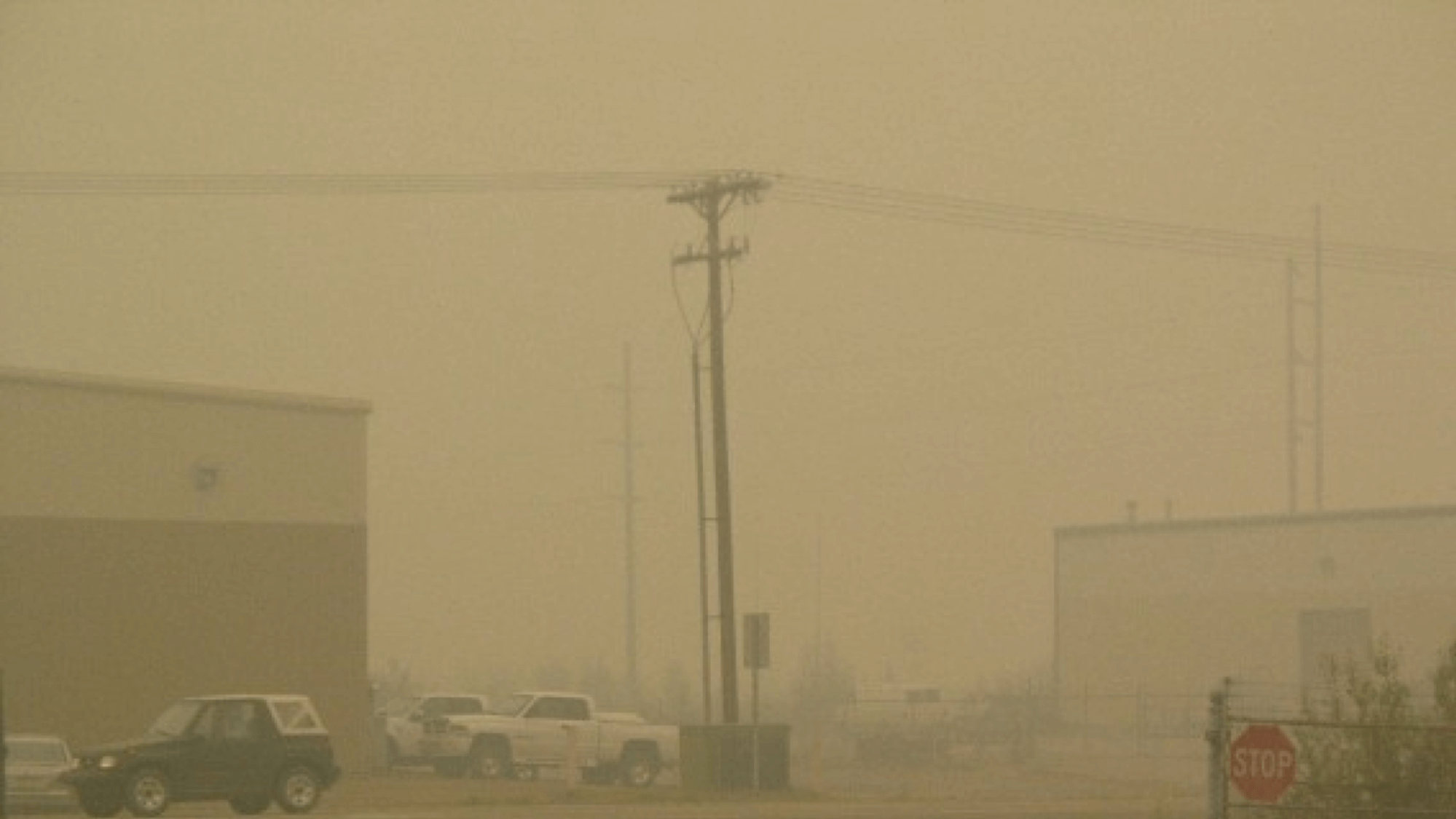
2004 is a summer that few in the city of Fairbanks can forget. The smoke emergency lasted into September, with 15 days at the top “hazardous” level, and another 31 days at “unhealthy” or higher.
But smoke like this has impacts well beyond health. Alaska’s transportation network and fire management operations are heavily dependent on aviation. Extreme smoke events like this bring air travel and fire management to a halt.
Alaska’s Fire Problem
Few Fires, Many Acres, Some of the Time
The number of wildfires discovered in Alaska doesn’t vary greatly from year to year. The total each year isn’t very impressive, generally less than that faced by a single busy response area in other parts of the country.
But once started, many Alaskan fires burn in areas difficult to reach, unrestrained by overmatched and unsafe suppression efforts. During active seasons, they will grow significantly on only the hottest and sunniest days of the driest periods. But on the larger and longer scale, these brief periods of high fire activity account for many dramatic fire events. A recent analysis showed that over 50% of the total area burned from 2002- 2010 burned during only 36 days – just 6% of the fire season.
We’re beginning to question previous assumptions about fire management in Alaska as we conduct studies to evaluate the combined effects of changing climate, landscapes, and ignition patterns. We’re evaluating where and when we should consider a more aggressive response.
Summer 2015: The Wake-Up Call
When fires get active during the peak season in Alaska, convective forces ignite blazes and reinforce the winds needed to produce major fire runs burning in heavy fuel loads. 2015 represents the surprise fire managers can face with the boom and bust pace found within seasons and between them.
That year fires burned the second largest area of any season on record dating back to 1940. After a low snow winter and a warm spring, two human-caused fires south of the Alaska Range started under hot, dry, windy conditions and threatened communities in the WUI just a week ahead of the summer solstice.
Though the weather moderated in the south after the major spread events, conditions remained very warm and dry in the interior. On June 19th, seasonal convective storms were again abundant and severe. Over 12 days, more than 230 fires were ignited by lightning. Seasonal preparations and fire day expectations were overwhelmed. And while typical July rains slowed and stopped most fires, it was only weeks later in August that concern for widespread late-season fire problems was allayed.
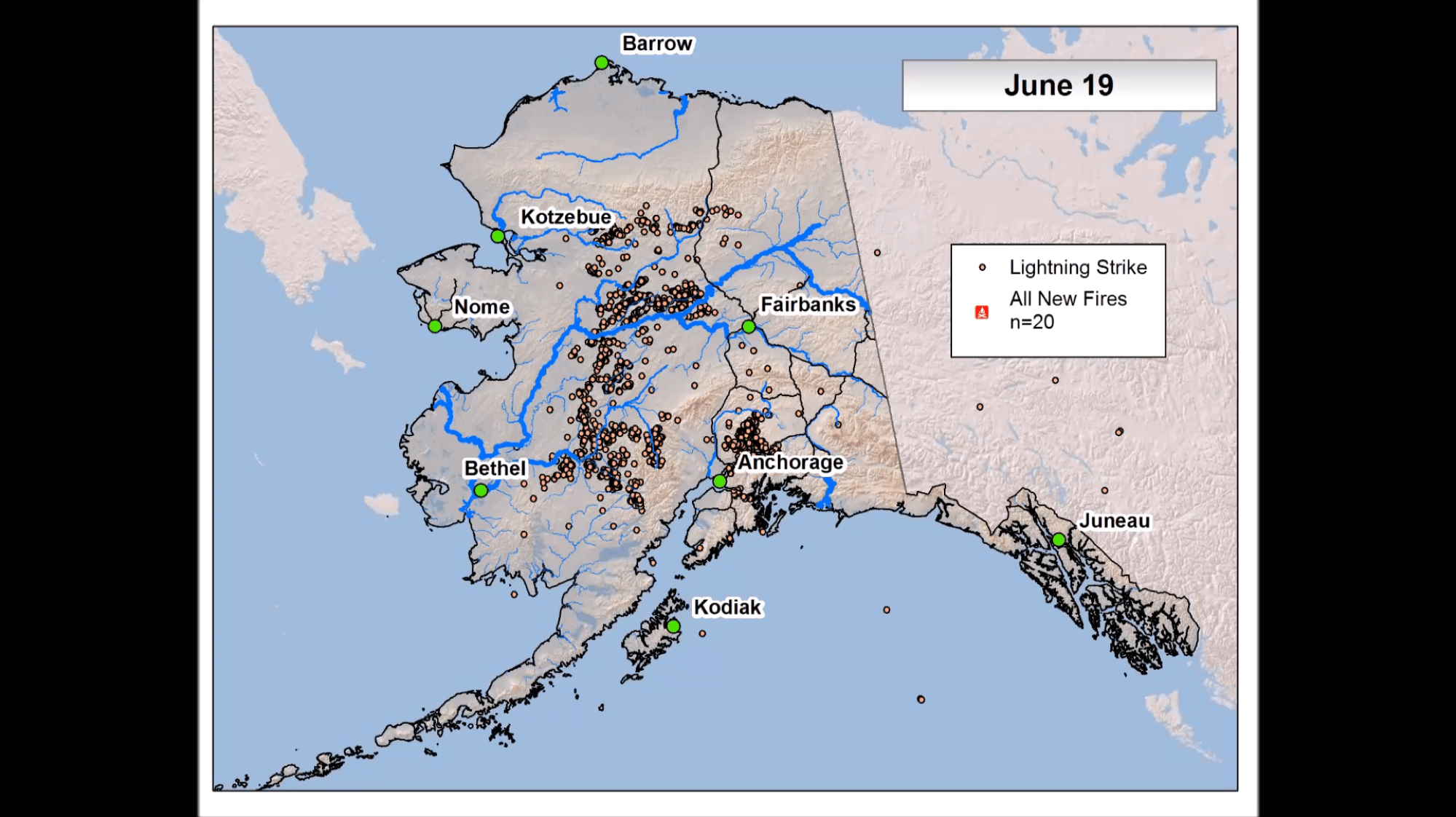
Stunning animation of over 230 lightning-caused wildfires in Alaska during 12 days in June of 2015 – IAWF Vimeo Channel
What it means to be OCONUS
Our ability to assess Alaska’s fire environment is impacted by lack of tools taken for granted in the lower 48 states and elsewhere. The next time you look at your favorite tool for fire assessment, see if there is a corresponding tool for Alaska. There are a few, but they suffer from lack of funding and support and are frustratingly unavailable when least expected.
Alaska is so separate from CONUS (Contiguous United States) in both the north/south and east/west directions that it requires a separate mapping domain for any reasonable resolution. Many projects don’t have time, money or resources for the extra effort required to understand their applicability in the far north. As a result, many processes, much of the data, and timing issues make fire management in the far north seem very foreign.
Unlike western CONUS, Alaska does not have access to traditional night-time IR mapping of fire situations. Day to day monitoring of significant fire activity in Alaska traditionally came from periodic intel flights to observe and map the most significant fires. We now have satellite tools, such as VIIRS RGB imagery, to detect fire intensity and fire movement of most of our fires on a daily basis.
Alaska has been using satellite fire detection data since the seemingly endless 2004 fire season when smoke rendered aerial observations nearly useless. Now with multiple polar-orbiting satellites passing over Alaska several times a day, results show that historic counts of MODIS detections very closely match trends in area burned, allowing a much more accurate picture of where and when fires have burned for sensitivity analysis. Instead of tracking where and when fires start, it is critical to track where and when relatively few fires grow throughout the fire season.
Distinguishing and mapping the locations of spruce, hardwoods, mixedwood forests and tundra seems like a straightforward task. And it is critical to understanding fire potential from any new start or growing fire. But the quality of our landscape maps is impacted by a lack of historic forest inventory and analysis data, resulting in a poor understanding of what is where.
While much of the western US can monitor, track, and validate the assessment of fuel flammability from a system of agency-managed, standard remote automated fire weather observation stations, Alaska’s fire agencies cannot maintain a sufficient network on their own. Using the CONUS approach (on the left) implemented in the Weather Information Management System (WIMS), there are only about 8 weather stations to cover the area of a typical state in the western US. On the right, Mesowest Alaska Fire & Fuels (AKFF) monitors at least 3 times as many stations from as many as 6 station networks. This has allowed us to manage a system adequately distributed across the state and fills important gaps in southwestern Alaska, the western interior, and the north slope.
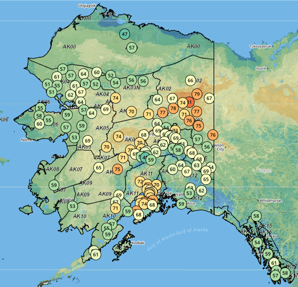
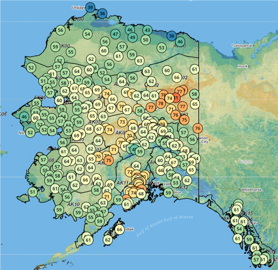
WIMS/RAWS network vs AKFF
While much of the fire-prone landscape in CONUS depend on fuels on the surface to ignite and support spread, Alaska’s landscape is characterized by deep duff layers under the boreal forest and tundra environments that dry more slowly, hold heat when dry, and resist extinguishment from all but season-ending weather events. This deep duff layer develops from very slow decomposition, holds a great deal of carbon, and provides a deep insulating blanket for the permafrost below. In an effort to understand our landscape flammability better, analysts use a range of tools and methods to evaluate the character and moisture levels in the duff under the boreal forest. Direct sensing of “soil” moisture with combinations of passive and active radar sensors from polar-orbiting satellites may eventually improve our current weather-based assessments of the current state of duff flammability.
Finding and supporting partners to help with far north assessments is pursued without much of the normal national support provided in the lower 48. One example, the Geographic Information Network of Alaska, has been providing remote sensing products to Alaska fire managers that are either not available elsewhere, timelier than provided nationally, or both (see https://akff.mesowest.org/map/).
Basic and applied research is also challenged by cross-applicability difficulties. One example, the NASA Arctic-Boreal Vulnerability Experiment (ABoVe) project was funded for 10 years in 2015 to learn about the boreal and Arctic environments. It supports interests in Alaska and our nearest neighbors in northwestern Canada. It is designed to learn about far north ecosystems, their disturbance regimes, permafrost, hydrologic systems, flora and fauna, and carbon pools to help manage our landscapes into the future. Few CONUS fire managers and policymakers know about or will ever use any of its results.
Alaska adopted the Canadian Forest Fire Danger Rating System (CFFDRS) for the daily assessment of fire potential, as well as fireline fire behavior assessments on our home ground. It is simpler and easier to manage. And most important, it provides better insight to landscape flammability, fire spread, intensity, and control difficulty. But again, it seems foreign to those who arrive from elsewhere to help us manage our fires.
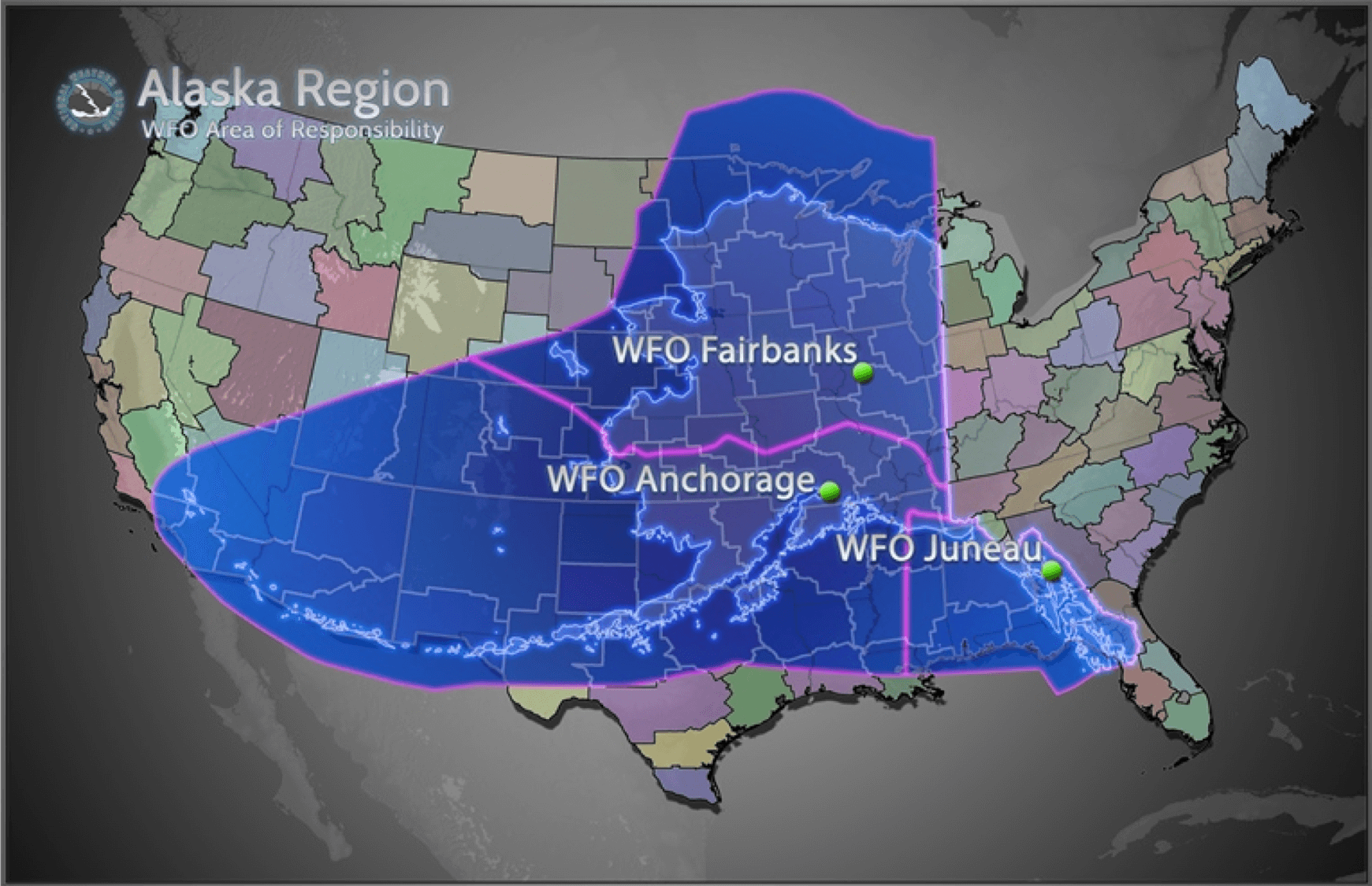
Forecasting Fire Weather
Consider the fact that the three offices in the image above have responsibility for a land area equal to about 30 offices in the lower 48. The radar is focused along the southern and western coasts, with only a single system established in the most burned interior. As a result, real-time information depends on surface observation and airport webcams to a much greater degree for much of the fire-prone landscape.
Alaska Interagency Coordination Center and Predictive Services
With our unique imperatives for fire weather assessment, the ACC began posting fire danger information in tabular form on their own site nearly 20 years ago.
In 2015, Alaska Interagency Predictive Services and Mesowest began operating a comprehensive site for access to fire weather, fire danger, fire behavior, lightning, and active fire detection information. This provides both gridded and surface observation, and forecast data giving ready access to current conditions, detailed 3- day forecasts, general 7-day outlook data, and historic record dating back to 1994.
Initiative – Alaskan Style
The state of Alaska has always had a population known for its character of confidence, fearlessness, vision, determination, and self-reliance. In that spirit, I present some examples of how we’ve taken the initiative to improve service to values at risk.
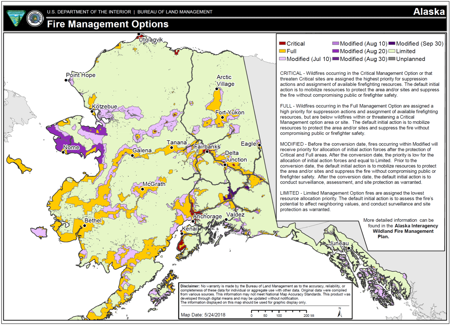
Alaska Interagency Fire Management Plan
Created in 1980, its heart is the Fire Management Options map that identifies a predefined initial suppression response for each of 4 levels of protection. The map is evaluated each year and modified as needed as part of annual updates to the interagency plan. Approaching 40 years of existence, it’s stood the test of time.
Alaska Spatial Database
A key tool for delivering point protection to the 14 thousand native allotments, the Alaska Spatial Database tracks the locations and character of these allotments, small remote communities, scattered infrastructure, and other key resources so that they can be easily identified from the office for prioritization of point protection from oncoming fires as they start. It is also easy to add new “Known Sites” to the database as they are discovered, using a tablet in the field that can be synced to the system upon return.
Climate Change-driven Collaboration
A recent study of climate change impacts on fire management decisions in Alaska identified protection of communities, enhancement of subsistence hunting opportunities, and protection of remote points on the landscape as the most pressing current challenges, with the protection of ecosystem carbon sinks as a looming concern. It was also discovered that our very small staffs limit individual agency effectiveness and that shared fire management responsibility require close interagency working practices.
Facilitation of these practices is a key element for success. Bridging organizations like All Lands/All Hands and the Alaska Fire Science Consortium have critical roles in ensuring that research is targeted and applicable and that communication (both formal and informal) is maintained among relevant actors.
Beyond its impact on sea ice, glaciers, and permafrost, we’re trying to understand how fire seasons are being impacted by the warming environment. As I struggle to grasp what will really happen as our climate changes and we continue to operate with the tools we have, there are unmistakable impacts already growing at an alarmingly increasing pace.
Fire activity is more frequent, increasing along with with area burned and the number of significant fire years. Smoke impacts are a growing concern for a huge state stitched together by aviation lifelines.
What if the typical July rains hadn’t come in 2015 and fires kept raging through September? Are 10 million acres burned possible? Will this scenario manifest, and is it even possible to prepare for?
What we do know is that those of us charged with fire management in Alaska have no choice but to keep up our determination and innovation in a landscape that’s changing beneath our feet, before our eyes, and above our heads.
About the Author
Robert “Zeke” Ziel is Fire Analyst, Alaska Fire Science Consortium, University of Alaska Fairbanks.
Growing up in the eastern forests of the United States, first in the Appalachians of southeastern Kentucky and then on the drift plains of southern Michigan, Zeke has been fortunate for a career that allowed him to observe and analyze the physical, biological, and human processes that have molded wildland landscapes. He spent nearly 37 years working in Michigan for the Michigan DNR, as a consulting forester, and as the program manager for the Lake States Fire Science Consortium. He learned and practiced fire assessment and analysis throughout the country as a Fire Behavior Analyst (FBAN) and Long Term Analyst (LTAN) for national incident management teams. These skills led Zeke to Fairbanks, Alaska in 2013, serving initially as the Fuels and Fire Analyst for Predictive Services at the Alaska Interagency Coordination Center for 4 years and now as the Fire Analyst for the Alaska Fire Science Consortium.
Resources
- Recording of Presentation: https://vimeo.com/334118398
- 2015 lighting/fire animation – https://vimeo.com/350208434.
- Alaska Fire Science Consortium. https://akfireconsortium.wordpress.com/.
- All Lands/All Hands Action Plan: Reducing Wildland Fire Risk on Alaska’s Kenai Peninsula. https://www.frames.gov/catalog/6611.